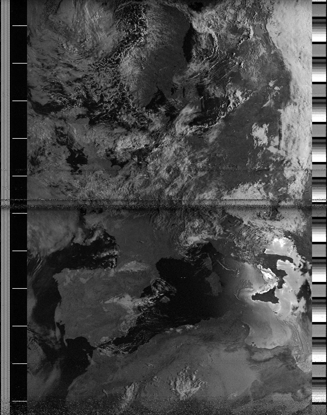
 Example image of Europe, the quality of the images depend mostly on
the antenna. Credit: JKamue
Example image of Europe, the quality of the images depend mostly on
the antenna. Credit: JKamue
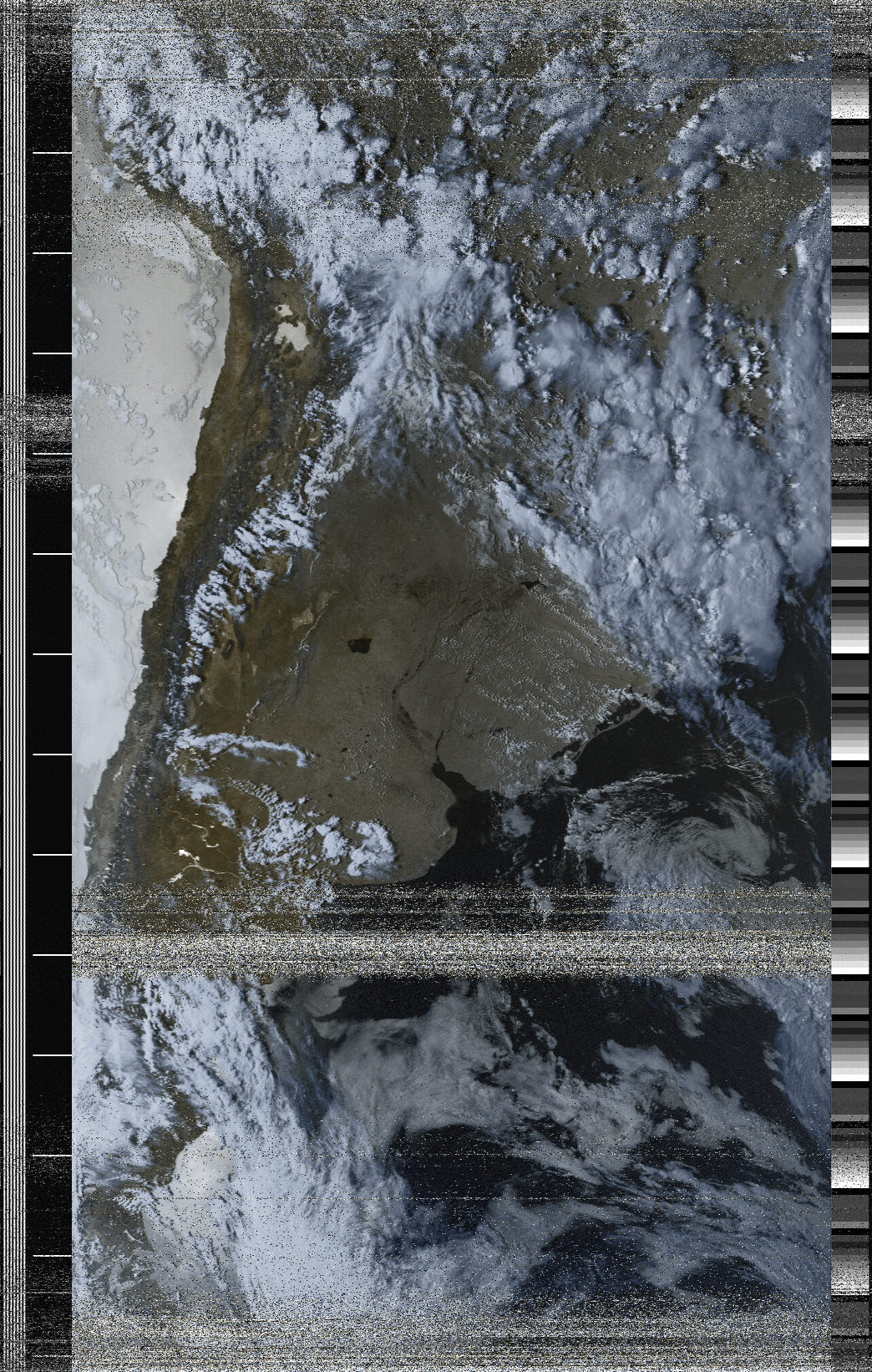 Another image, but with false color.
Receive and decode images from weather satellites
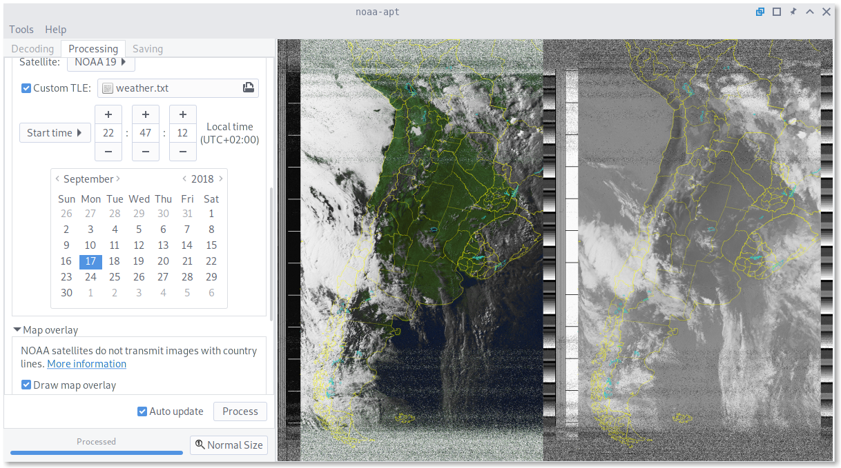
noaa-apt takes a recorded WAV file and decodes the image. As an example, this is a WAV file I recorded using GQRX using a RTL-SDR and a double cross antenna. When loading that file on noaa-apt, you get as a result this image.
Why?
NOAA satellite reception is fun, cheap and relatively easy. You can buy a RTL-SDR for less than 30USD, it looks like a USB drive but it has a connector for antennas. Using SDR software like GQRX and SDR# you can receive FM signals, for example broadcast FM (around 100MHz) or better, receive APT signals from NOAA satellites (around 137MHz) and then decode them with noaa-apt.
I made noaa-apt because WXtoIMG, the most popular decoding software, it's propietary and no longer maintained, but you can get old recovered versions from an unofficial website. Also, the steps required to decode WAV files on it are not that obvious.
There are lots of really good Alternatives, but all of them require compilation, Python or don't provide graphical user interfaces. So I wanted to create an easy to use alternative for Windows users, being useful to advanced GNU/Linux users doing some kind of automation too.
Disadvantages
WXtoIMG has better false-color and image overlays, also has features noaa-apt does not have (like live decoding). Anyways, the quality of the black and white image should be the same in both programs.
If you get some kind of error or bad result open a Issue or send me an email. Both the code and the website is on the GitHub repository.
Screenshot
About NOAA images
- NOAA satellites are transmitting images 24/7, and the image you receive is a real-time image of your location. The transmission is free to be received by anyone with an antenna, and there is no official decoder or receiver.
- NOAA images are black and white. When you see a color image it means it was colorized.
- NOAA images do not have map lines (divisions between countries, states, or coastlines). When you see images with lines, it means that they used noaa-apt or WXtoImg to draw them according to a map and calculations about the position of the satellite when the image was taken.
- The images are upside down 50% of the time, that's because the satellites sometimes go from south to north and sometimes from north to south. noaa-apt and WXtoImg can calculate the orbit of the satellite and rotate the image accordingly.
- Images look much better on daylight, the satellites also send infrared images at night but I recommend receiving passes when the sun is high in the sky.
Features
- Decode raw images from WAV files.
- Add map overlays with countries, states, provinces and lakes.
- False color.
- Really easy to use (at least easier than other decoders).
- Histogram equalization.
- You can disable syncing and export every step of the decoding process, useful for corrupted recordings.
- Telemetry band reading.
- Resample WAV files preserving modification timestamps.
- Modify timestamps of files.
- Edit filter parameters from a configuration file.
- Rotate the output image, in case of ascending (South to North) passes.